Der Kirchbergweg


- 2:05 h
- 7.07 km
- 174 m
- 174 m
- 107 m
- 281 m
- 174 m
- Start: Parking lot at St. Kilian's Church, Höxterstraße, 32676 Lügde
- Destination: Parking lot at St. Kilian's Church, Höxterstraße, 32676 Lügde
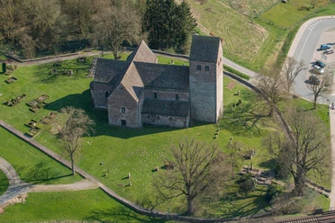
The Lügder St. Kilian's Church and the Kirchbergweg are closely linked to the mountain villages of the Pyrmont plateau. The faithful regularly descended into the valley to get to the church, which was the main church for them.
Today, the Kirchbergweg leads partly along the path used by the faithful at that time and thus gives an idea of the effort they took to attend church services in Lügde.
On the top of the Kirchberg, beautiful panoramic views of the surrounding valley await. Far away from the roads, the circular hiking trail also offers relaxing views of nature and plenty of peace and quiet.
With its moderate level of difficulty, the Kirchbergweg is also a delightful experience for inexperienced hikers.
Good to know
Pavements
- Asphalt (1%)Gravel (2%)Trail (81%)Path (16%)
Best to visit
- suitableDepends on weather
Directions
- The starting point of the hike is the parking lot at St. Kilian's Church. From there, the trail leads uphill along a hollow path to the Kirchberg. A bench at the foot of the hollow path describes the origins of this hollow path as a high-level or long-distance path. After approx. 350 m, the rest area "An den Kirchberghütten" invites you to take a short breather. Continue uphill on the grass/gravel path to the right of the Kirchberghütten, where you can still see the remains of this old hollow path and the section of the Kirchweg on the right. The path now runs along the edge of the forest towards the oak forest with a wonderful view of the entire Lügder valley. Here too, the history of the oak forest is briefly explained on a bench sign. After a slight ascent through the approx. 200-year-old oak forest and crossing a meadow, we reach the old Fernweg or Kirchweg again. From here, there are wonderful panoramic views of the Köterberg, the Mörth, Herlingsburg Castle and the Teutoburg Forest in the distance. Here, too, you will find a bench sign explaining the Kirchbergweg and the boundary stones from 1844, which mark the border between Lower Saxony and North Rhine-Westphalia. The route continues in the direction of Großenberg. After approx. 900 meters, we reach the "Messberg" forest edge after a slight ascent. Via a forest path, we then reach the Lippischer Pilgerweg after approx. 200 meters, which we follow for another 200 meters. Along the edge of the forest at the Kirchberg huts, we now reach the starting point at the Kilianskirche via the already familiar hollow path.
Tour information
Barrier-Free
Familiy-Friendly
Loop Road
Tour with Dog
Equipment
- Sturdy footwear is recommended due to the changing surface.
Directions & Parking facilities
- Getting thereYou can find detailed directions on how to get here by car here.Parking
About 10 parking spaces are available at the starting point. You can find an overview of other public and free parking spaces here
.Public transportationTravel by bus (bus stop: "Schlieker"):
Travel by train:
The starting point of the hike can be reached on foot from the train station in approx. 15 minutes.
Further information can be found here.
Additional information
- If you are interested in other hiking trails in and around Lügde, we recommend looking them up here.
More information
- This trail is not yet marked. It is only possible to walk the trail using GPS data or this online map.
Contact person
Author
Organization
License (master data)
Tourist-Information Lügde

Author´s Tip / Recommendation of the author
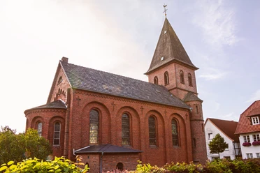
- The tour offers wonderful panoramic views of the surrounding countryside and should be rounded off with a visit to the historic St. Kilian's Church.
Safety guidelines
- Due to the uneven nature of the path, we recommend wearing sturdy shoes.
Nearby




Download GPX file